
IV De Kinkhoorn
De Kinkhoorn 17 — May 2008
Volume 9, number 1
This issue as pdf (Dutch) · Read the Dutch original · the printed original
- Foreword
- On freeholders, regents and nobles: the rise and flourishing of the Fogelsangh family
- Patriciate and the Kingmas (continued)
- Zweins and Kingma State on old maps (2): the map by Jacob van Deventer
- Announcement of the complete genealogy of the Kingmas up to and including 1700
- Rebuilding states: kitsch or new glory?
- Kingma Kronkels: Roots
Foreword
In a reprint of "ALGEMEENE GESCHIEDENIS VAN FRIESLAND", written by HaringWiegers Steenstra, teacher in Dongjum and originally published in 1845, I read the following.
In het jaar 1507 begon men de trekvaart van Leeuwarden op Franeker te graven, die in dat jaar tot aan Kingmastate gebragt, en in het volgende tot aan Franeker vervolgd werd.
That must also be when the bridge was built from which Kingmatille takes its name. This date fits well with the oldest known map of the province, which is the subject of the continuation of my series of articles on old maps on which Zweins appears. On this map from 1545 the canal from Leeuwarden to Harlingen is clearly visible.
You can read about the remarkable coincidence of events that allows us to study this old map today, even though no copies of the original map still exist, in the article concerned.
It is common knowledge that the aforementioned canal was widened after the Second World War in 1946, after which it was from then on called the Van Harinxma Canal. As a result of this widening the bridge at Kingmatille disappeared and a ferry took its place, which in turn disappeared again in 1963, to the sorrow of the local residents.
A little over two years ago, residents of the surrounding area took the initiative to work towards a small ferry for cyclists and pedestrians. Unfortunately, due to all sorts of opposition and objections, mainly from residents not originally from the area, the realization has been greatly delayed.
Personally, I believe that, historically speaking, the connection across the canal should be restored. Instead of disruption, I expect a revival of the hamlet. I therefore wish the foundation "Keimpetille, it pontsje werom" every success.
Kees Kingma
Chairman
On freeholders, regents and nobles: the rise and flourishing of the Fogelsangh family
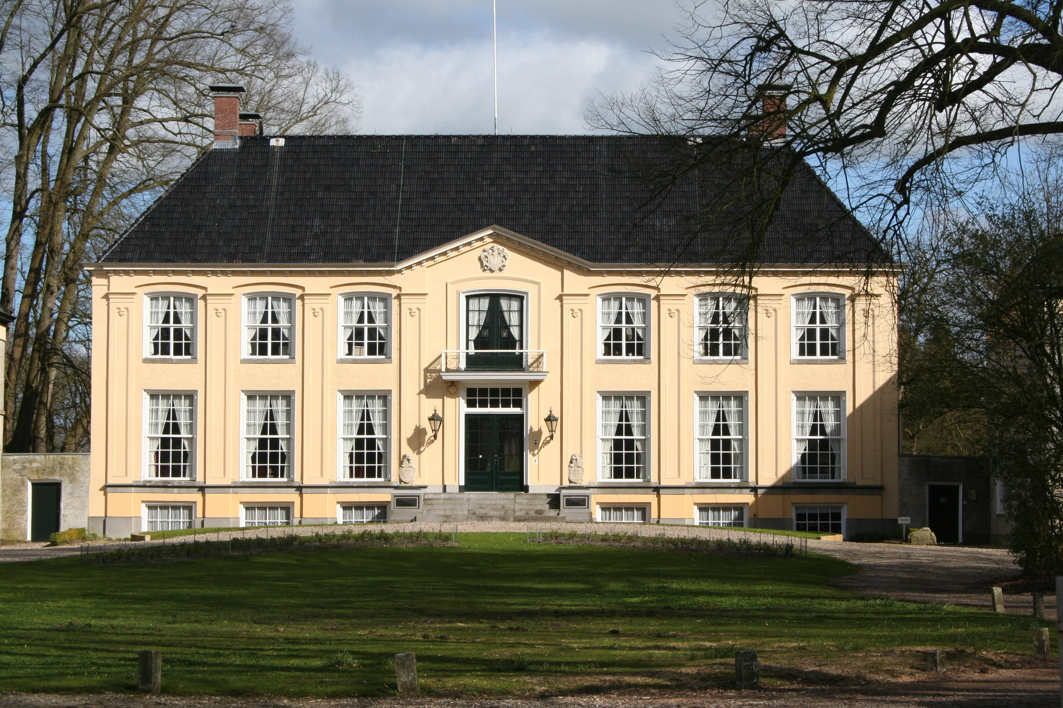
In the fifteenth and sixteenth centuries a family rose to prominence in Friesland that developed from the ranks of the eigenerfden (freehold farmers) into a family of regents with a quasi-noble lifestyle. They underscored their newly gained standing with their residence, Fogelsanghstate. Kees Kuiken and others1 wrote a fine book about this state (a Frisian manor house with attached land) and the Fogelsangh family, which also offers insight into the delicate social relations of that time, in particular the distinction between eigenerfden, the regent patriciate, and the nobility. Hence the telling subtitle, ‘the renaissance of a Frisian farming family.’ That renaissance applied to the Fogelsanghs, but might also hold to some extent for their contemporaries, the early Kingmas of Zweins, who were moreover connected to the Fogelsanghs twice through marriage. This theme from the book mentioned above therefore also deserves attention in De Kinkhoorn. Where the book is quoted verbatim, the text is placed between quotation marks.
Fogelsanghstate was built on the foundations of the former Veenklooster in Kollumerland, which was bought in 1644 by Dirck Fogelsangh. This Fogelsangh, referred to as Dirck II, was a grandson of Dirck Fogelsangh I, whose sister Hylk Gerritsdr Fogelsangh married Jelle Pieters Kingma in 1551. Dirk and Hylk's brother, Folkert Gerrits, married Sieuw Yntesdr Kingma, a full cousin of Jelle Pieters, around 1580. The Fogelsanghs developed the monastery estate into a ‘manorial Zathe (a Frisian farmstead), which by the eighteenth century was recorded as the heerlijkheid of Fogelsangh.’ That was also the time when the state had passed by inheritance into the possession of the noble van Heemstras. The state eventually passed to the van Harinxma thoe Slooten family, who still own it today.
The Fogelsanghs themselves had no noble quarterings, although they did descend from a family of freehold farmers, and there was ‘an ancestral mother who came from a milieu that held law-administering states and exercised manorial rights, but had become estranged from those rights.’ Many states, including Kingma State, lost their manorial rights around 1500, to the displeasure of their occupants, not infrequently freehold farmers. In the sixteenth century the Fogelsanghs still married exclusively within their own circle of wealthy freehold farmers, which is why there were two marriages with Kingmas. At the same time they intensified their contacts with Reformation-minded Frisian nobles, such as the Harinxmas, which is how the aforementioned Dirck Fogelsangh I came to study in Heidelberg. The University of Leiden had not yet been founded when ‘Theodorus Vogelsanck and Petrus de Harinxma enrolled at the Reformed university of Heidelberg in 1568.’ Dirk (Theodorus) Fogelsangh's (Dirck I's) university studies made possible a leap in status from wealthy farmer's son to regent. In this way he played an important role as an administrator and diplomat in the conflict with Philip II. His grandson, Dirk II, bought the core lands of what would become Fogelsanghstate. The state's holdings were extended with voting zaten, which allowed its occupants to take part in the grietenij (Frisian administrative district, roughly comparable to a municipality) government on the footing of a nobleman. Yet that was appearance only. In the seventeenth century the nobility increasingly closed itself off from the adjoining layer of freeholders. The Fogelsangh family, by then partly known as van Doma, experienced this too, when the quasi-noble in-laws (van) Tadema disputed the status of the Fogelsanghs/Domas. All manner of juggling went on with lines of descent, ancestral estates, manorial rights and the like, just to belong to the right rank.
So what does all this have to do with the early Kingmas? The Kingmas, like the Fogelsanghs, appear on the scene in the middle of the fifteenth century. It has been speculated that the first (thoe) Kingum might have been a bastard of the Sjaerdas, the powerful hoofdeling family (medieval Frisian landed chieftains) who had long owned, among other things, Kingma State, including its associated ‘manorial rights.’ In Friesland ‘manorial rights such as swan hunting, the appointment of the parish priest, and participation in the rechtsomgang (the travelling circuit court) were not tied to a family's status but solely to the actual ownership of a state.’
‘Kingmazate, before it became the property of the Kingmas, was such a law-administering or noble state. That the Kingmas were later freeholders on their zate is beyond dispute. It was indeed on the strength of owning the zate Kingum that in 1529 Pieter te Kingum, together with his brothers and sister, claimed the swan right (and thereby the manorial right) in Zweins before the judge. Pieter claimed that the zate had been in the Kingums' possession for fifty years, but could produce no deeds to prove it.’ The outcome of the lawsuit is unknown, but nothing more is heard of manorial rights afterward. Perhaps it played a role that the judge, Gerrolt van Herema, had an interest as the husband of Luts van Sjaerda and a neighbor of the Kingmas in Zweins.
Just like the Fogelsanghs, then, the Kingmas were quite preoccupied with their status. Descending from a freehold farming lineage, they, like the Fogelsanghs, seemed to want to secure a place amid the administrative, largely noble elite of the time. The upgrade from zate to state in the seventeenth century also fit their striving for advancement. Several Kingmas held important offices in that period, and some of their children studied at the universities of Franeker and Utrecht. The most important is without doubt the much-discussed Ynte Saeckles (Ignatius van) Kingma, who broke off his law studies and chose a military career instead. He kept up the style of a nobleman on his state, but he was also the end of the Kingmas' story on Kingmastate.
And so it goes for the Kingmas just as it did for their relatives the Fogelsanghs. Their possessions passed to other, later noble families, and we no longer see them active in high office. Unlike the Fogelsangh family, though, the Kingma family lives on. No nobility, no regents, but farmers, burghers, country folk, bailiffs, bankers, burgomasters, bargemen, bakers, and builders, in every corner of society. A family now branched out across the world, which in all its diversity shares a common old freehold origin, along with a dormant memory of an unproven claim to ‘manorial’ rights.
J. Herre Kingma
1 “Van Fûgelsang tot Fogelsanghstate”, by Kees Kuiken, Reinder Postma and D.J. van der Meer, publ. Banda, Kollum 2003.
Patriciate and the Kingmas (continued)
Thank you for sending the beautifully produced Kinkhoorn, once again with interesting and informative pieces. Rereading my own contribution, I note that I could have made use of an open goal. I could have made the connection between your uncle Cees's interest in old maps, on which Kingmastate appears, combined with the phenomenon of the patriciate and the considerable status of the Kingmas up to 1700 as shown by the recently published genealogy. On the maps of Schotanus (1664 and 1718), Kingma state is indicated as a freeholder state (a Frisian manor house with land), or, in Latin, patriciorum sedes. A noble state is a sedes noblium.
Let me continue for a moment on that sedes patriciorum of the Kingmas. Their marriages, their houses, their public offices, children studying at university, during the sixteenth and seventeenth centuries, point to a way of life that corresponds to the class denoted by the Roman concept of the patriciate. Freeholder families who managed to hold on to that, such as the (van) Beijma's, the Sminia's and others, were able in the 19th century to successfully apply for nobility from the King. Had the line of Ignatius continued to exist, his descendants would undoubtedly also have been granted that status. That is how many old patrician families have come by their noble titles today. To be clear, the listing of our line in Nederland's Patriciaat is not based on that. Hylke Jans and his descendants were newcomers, homines novi in their time. Their descent on the mother's side may have given them a small boost, but it was not decisive. It was simply their entrepreneurship and civic spirit, which they, and later their descendants too, underscored with offices in public administration.
In short, the old Kingmas are by origin unmistakably a patrician family, one that, however, like most of their peers, was unable to hold on to that status. Herman van Slooten referred to this, somewhat mockingly, as having "sunk back into the farming class," but the roots are unmistakably there, and we are all proud of that today. That loss of status occurred very often at the end of the seventeenth and in the first half of the eighteenth century. A limited number of regent families excluded families that fell only slightly outside their circle from offices, which they divided among themselves. The number of freeholders who were deputies around the year 1600 was roughly equal to the number of nobles (see Jonathan Israel, The Dutch Republic). By around 1700 that number had been decimated in favour of the nobility. They were simply squeezed out. Well-known published examples of this exist, such as the family Van Hulten, a family on my great-grandmother's side. A distant female ancestor of Van Hulten, of Mennonite Groningen city-patrician stock, married a Groningen squire. On the funeral hatchments with quarterings made later, her name was deliberately erased. The 'unjust' thing is that a nobility title, once acquired, remains hereditary regardless of status, whereas something like a patriciate has to be proven again every single time. Whether our branch would still be able to do that in 25 years, if this already much-diluted phenomenon even still exists by then, is very much the question. I see our registration more as a codification of a closed chapter. Our line, too, has become history. Henk Nicolai put it somewhat ironically: the Kingmas (of Makkum) are building their past.
A revival of Kingma state should also not be a revival of lapsed status, but a revival of history.
So much for a few reflections.
Regards, Herre
21 October 2007
Zweins and Kingma State on old maps (2): the map by Jacob van Deventer
Maps on which Friesland appeared as part of a much larger depicted area were already being made in Roman times. But the oldest provincial map is by Jacob van Deventer, published in Mechelen in 1545 together with maps of the other provinces of Brabant, Holland, Gelderland and Zeeland. The map of Friesland also shows Groningen, Drenthe, Overijssel and part of East Frisia.
Jacob van Deventer, also known as Jacobus a Davenentria or Daventriensis, was born in 1501 or 1502 in Kampen or Deventer and died in 1575 in Cologne. He attended the Latin school in Deventer, after which he began studying medicine, mathematics and geography (surveying) in Leuven in 1520. From 1530 onward he was commissioned by the States to survey and map the Dutch provinces. In doing so he was one of the first to make use of triangulation. Around 1540 van Deventer was appointed imperial geographer by Charles V.
No copies of these maps from 1546 are known to survive. That these maps existed is evident from references in a number of sources.
In 1916, W. Ruge discovered in the “Stadt- und Universitätsbibliothek” of Breslau (present-day Wrocław) the maps that Bernaerd van den Putte made based on the maps of Jacob van Deventer, published in Antwerp in 1559. These maps are now considered to be the second state of van Deventer's original maps from around 1545. This is based on a comparison with the map by Tramezini, who in 1556 copied van Deventer's 1545 map of Friesland at a smaller scale.
Bernaerd van den Putte (1528-1580) was a son of the cartographer Matthias van den Putte of Antwerp. After 1553 Bernard set up independently as a figuersnyder on die Lombaerde veste, likewise in Antwerp.

Until the spring of 1945, the last known copies of the second state of these wall maps were in the possession of the Municipal Library of Breslau (now Wrocław, Poland, on the Oder).
During acts of war, the maps, which had been stored in a castle in Silesia, were lost.
Bernhard van 't Hoff, city archivist of Deventer, had a facsimile made in 1941 from photographs obtained from Breslau. These maps were then published, together with an explanatory note by B. van 't Hoff, by Martinus Nijhoff of 's Gravenhage, in a portfolio entitled: “De kaarten van de Nederlandsche provinciën in de zestiende eeuw”.
Some of the provincial maps are copperplate engravings; others, such as the map of Friesland, are woodcuts. Bernhard van 't Hoff therefore wonders whether van den Putte perhaps made use of the woodblocks of the original edition — all the more so since otherwise he must have followed the original edition very faithfully.

The accompanying photographs were taken by me at Tresoar, where two copies of this portfolio are held in the depot. One of these is owned by the Ottema-Kingma Stichting.
The map of Friesland was made in four, slightly overlapping sections. The first section reproduced here shows almost the whole of Friesland.
In the upper left corner is the coat of arms of Charles V, next to it the coat of arms of Philip II, both with the Order of the Golden Fleece hanging from them. To the right of that is the coat of arms of Friesland.
In the first photograph of the whole map, in the middle on the left, in a decorated frame, is the year 1545 and a Latin dedication to Maximiliaan van Egmond, Count of Buren etc., stadtholder of Friesland, Groningen and Overijssel for Charles V from 1540 to 1548. Above it is the coat of arms of Van Egmond.
The following details on this map are striking.
There are no roads shown, only waterways.

The contours (dikes) of the former Middelzee and of Het Bildt are indicated, with “de Sweth” — now “de Zwette” or “Sneekervaart” — running between them.
Off the coast near Makkum lie two small islands.
Above Groningen there are two islands that no longer exist, “Heffesant” and “Bosch” or “Coornsant”. Near the northeastern point of Friesland there is also a small island called “Banck”.
The names of important places, such as “Franicker”, the districts and Het Bildt, are printed in Gothic lettering.
The towns are indicated by town profiles, through which their importance is expressed.
The villages are indicated with a small church.
Zweins is listed as “Sweyns”.
Kingmatille and the State are not shown.
Sources
Deventer, Jacob van. 1941. De kaarten van de Nederlandsche provinciën in de zestiende eeuw. Facsimile-uitgave naar originelen uit 1545-1560. 's Gravenhage: Nijhoff.
Hoff, B.van 't 1941. Toelichting bij de kaarten van Jacob van Deventer. 's Gravenhage: Nijhoff.
Keuning, J. 1913. De Kartografie van Friesland in de 16e eeuw. Tresoar: Pb 4301
Keuning, J. 1914. De Kartografie van Friesland tot 1600. Tresoar Pb 4302
Rijke, P.J. de. 2006. Frisia Dominium. 't Goy-Houten: Hes & de Graaf Publishers BV.
Wijk, P.H. 2006. Groninga Dominium. Groningen/Assen: Stichting Uitgeverij Philip Elchers en Koninklijke Van Gorcum
Announcement of the complete genealogy of the Kingmas up to and including 1700
In the printed Kinkhoorn the complete genealogy of Jelle van Kingum and his descendants up to and including 1700 was shown here.
The following Kinkhoorn will be devoted in its entirety to this genealogy.
Rebuilding states: kitsch or new glory?
During the donors' meeting on 10 December 2007, traditionally held in the village hall of Zweins, architectural historian and author Peter Karstkarel gave an exceptionally engaging introduction on the architectural history of stinzen (fortified stone houses) and states (Frisian manor houses with land) in Friesland.
We had invited Kartskarel because he is known to us as a critical observer of the rebuilding of states, an expert who can also openly voice his disapproval in the media if something does not sit well with him.
The board of the Stichting Herstel Kingma State feared they would get a dressing-down from Karstkarel about the upcoming rebuilding plans. Nothing could have been further from the truth. We were given an extremely instructive lesson of some two hours about every kind of historical stins and state in the province — existing, vanished, and even ones that were never built. A tour of how it should be done, and especially how it should not.
His account starts in the 14th century with the Hottemastins, which had to protect family and vassals against attacks by the neighbouring enemy. From the end of the 12th century, tuff stone was gradually replaced by brick as a building material. Whereas tuff stone had mainly been used for building churches, brick also came into fashion for stone houses. These were often built as a stone tower (torenstins) or hall (zaalstins), particularly in Westergo and Oostergo.
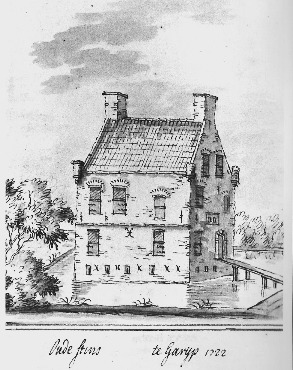
A good example of such a torenstins is the one in Garyp, as shown here in a drawing by J. Stellingwerf from 1722.
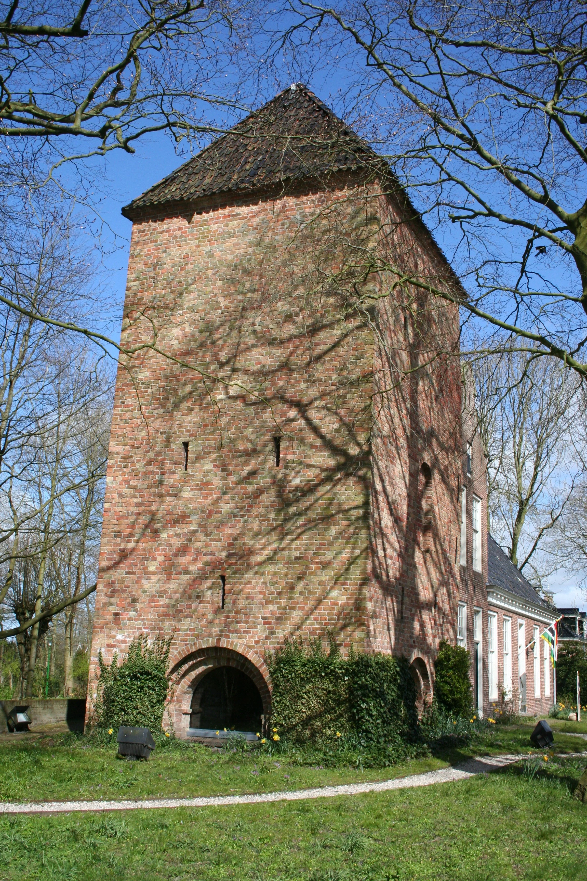
The only surviving stone residential tower is the Schierstins in Veenwouden (see illustration). According to Karstkarel, not much of it is still original. The tower has been rebuilt many times.
Usually the ground floor was not lived in; people lived on the first floor and above, so the occupants could not be smoked out. To get in you needed a ladder. Moreover, you would then be above your opponent, who could throw pitch and other things at your neck. This stins is named after the schiermonniken (grey habits) of the claercampsterklooster.
In Swichum there stood a beautiful zaalstins, Ayttastate, as can be seen in the accompanying drawing from 1786 by J. Gardenier Visscher.
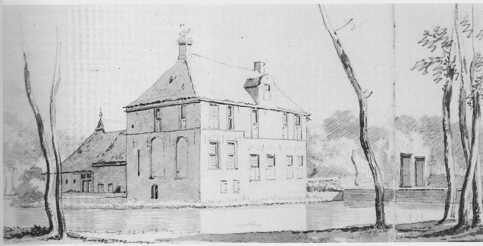
From 1520 onward the factions in Friesland stop fighting each other and a prosperous period begins in which this economically healthy region grows rich. This translates into a growing number of castles, but also into richly decorated Renaissance grave slabs in the churches. Such a slab could cost as much as three times an ordinary house. The stinzen are now being demolished because of their unwieldy thick walls and floors. The bricks are reused as the foundation of the new house. An example of this is Tjaardastate in Rinsumageest. We see this state in a drawing by Sjoerd Bonga from 1834, shortly before demolition.
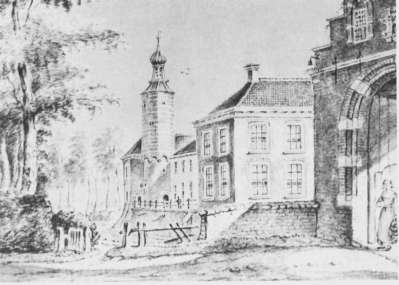
A photo from 1886 of Heringastate/Poptaslot is, according to Karstkarel, a good example that could serve as a source of inspiration for the rebuilding of Kingma State.
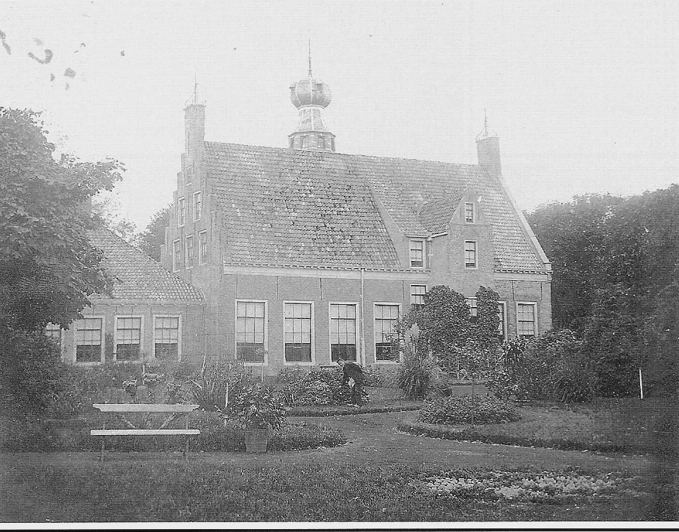
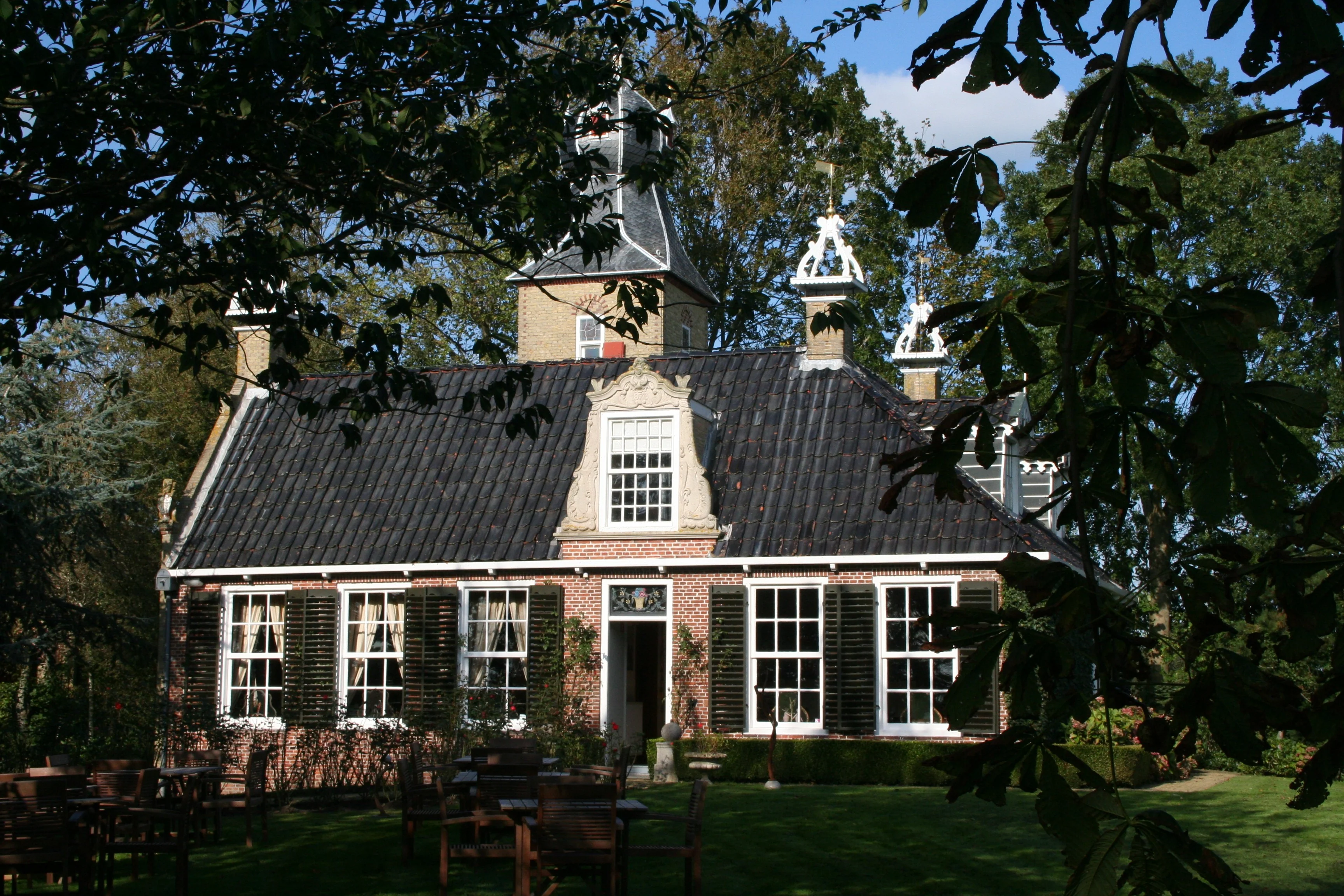
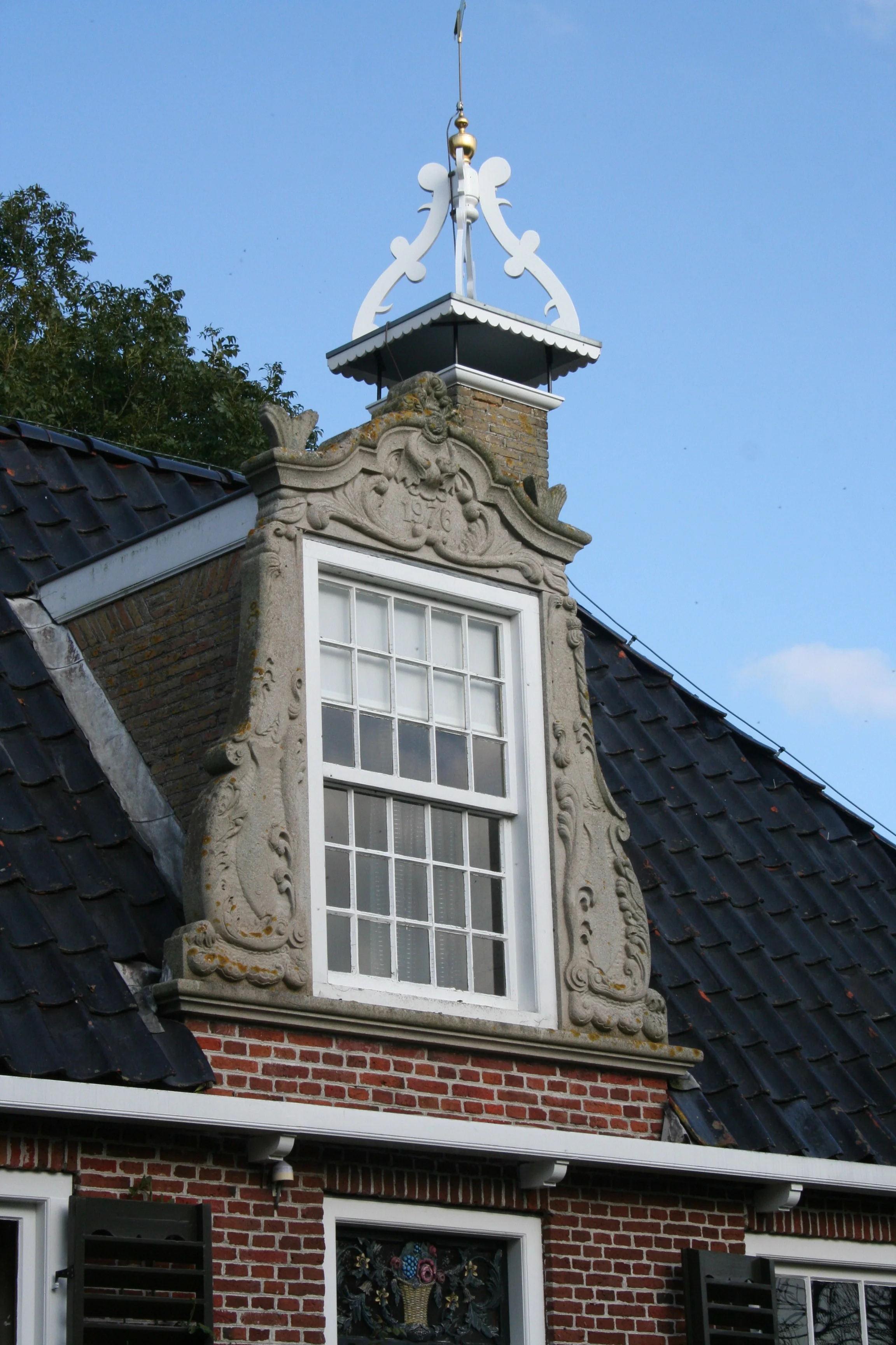
Karstkarel is more in favour of 'new and authentically contemporary'.
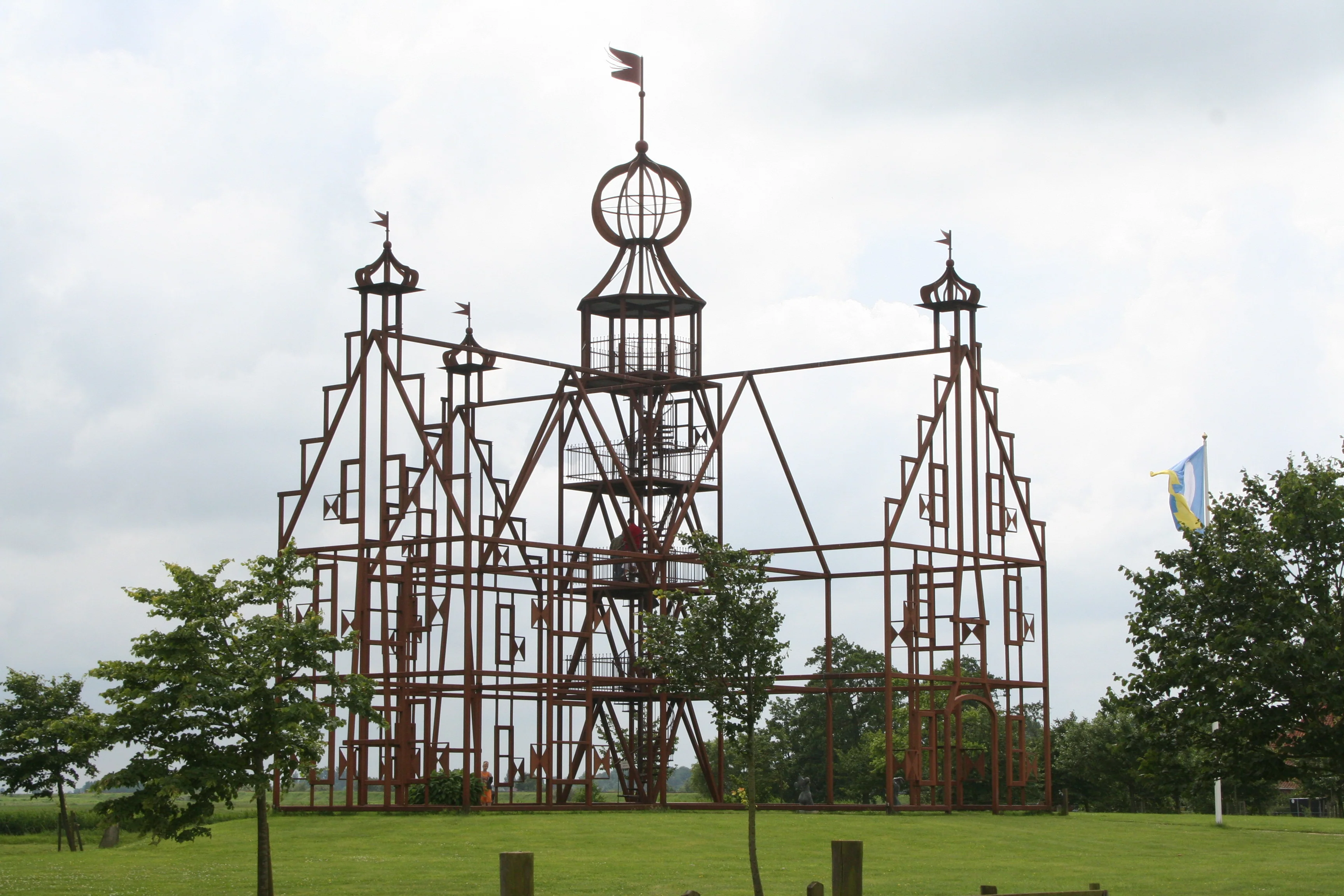
And if that doesn't work out, you can always go in the direction of the rebuilt Uniastate, with just a tube frame, as can be seen in the accompanying photo.
And finally, Kingma State in the middle of the 19th century.

Joost Kingma
Kingma Kronkels: Roots

Joost Kingma
Last time I remarked that every bird sings as it is beaked.
And that can produce a fine harmony, as we could observe, because there were three complementary articles about our roots: the name Kingma, Kingma State on old maps, and the Kingma genealogy. That, of course, calls for a repeat performance. And once again Fogelsanghstate plays a role, namely in the contribution by Herre Kingma, who delved into the relationship between the Fogelsanghs and the Kingmas, and in the report of the talk that Peter Karstkarel gave during the donors' afternoon in the autumn on the architectural history of stinzen (fortified stone houses) and states (Frisian manor houses with land) in Friesland. It was an exceptionally amusing and interesting story, much appreciated by the donors present and by both board members of the Herstel Kingma State foundation, who, as project developer and estate-owner-to-be, are highly fascinated by the question of how the historical allure of states can be translated into the design of an entirely new complex of a handful of homes. Because that process, too, is making progress. In February the municipality of Franekeradeel sent our design principles for the rebuilding of the state to the province, in order to qualify for the status of a pilot estate (they themselves use the word "pilot" for this, but I myself don't find the combination of estate with pilot especially well chosen, although as a passenger you usually do hope a pilot lands well). In May the first concept sketches for the layout of the area, by landscape architect Michael van Gessel, will be presented to the municipality and the province. We ourselves are very enthusiastic about this first design proposal for the estate-in-the-making. We hope to be able to tell you more about it during the next donors' meeting. That is, if you're in the mood for it then, since you might prefer to exchange thoughts about the Kinkhoorn that will have appeared by then, which will be entirely devoted to our roots: the genealogy of the Kingmas up to 1700.